
Archaeological Site Survey Unit by the Latest Science
Unit purpose /Goal
Sato Laboratory is promoting "Radio Science Research Aiming at Disaster Mitigation".
There is a strong social need for new technologies for efficient archaeological surveys,
such as the prospect of a large number of urgent archaeological surveys when relocating houses to higher ground following the Great East Japan Earthquake.
This project research unit aims to develop archaeological site survey technology using advanced underground measurement methods such as ground penetrating radar,
practical technical cooperation for archaeological site exploration by local governments, and practice of cultural property protection through technical guidance. I will.
The number of archaeological surveys associated with housing and road development reaches 10,000 annually in Japan,
but the Agency for Cultural Affairs is working to improve the efficiency of surveys by introducing non-excavation methods such as
ground penetrating radar in addition to conventional archaeological surveys.
The Nara National Research Institute for Cultural Properties provides guidance on the introduction of such technology to local government cultural property managers.
In this project, the Tohoku Asian Research Center, which is located in the Tohoku region and has been involved in the development of ground penetrating radar technology for over 20 years, cooperated with the Nara National Research Institute for Cultural Properties.
We will prepare to establish a base where we can provide practical guidance on exploration technology, and provide on-the-job guidance more efficiently.
The purpose is to contribute to the protection of cultural properties by developing new exploration methods.
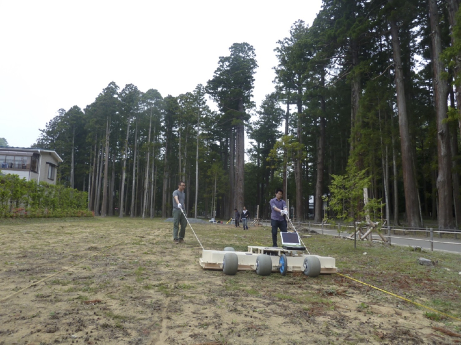
In February 2013, we completed an array-type ground penetrating radar for archaeological site exploration with the support of the International Research Institute for Disaster Science,
Tohoku University, as a method for conducting large-scale surveys in a short time. We have already conducted an underground survey of archaeological sites related to the
reconstruction of the earthquake in Higashi Matsushima Town, Natori City, Yamamoto Town, Minamisoma City, etc.
In the next few years, it is expected that on-site measurement using our research results and associated education and research activities will be activated.
Demonstrated that efficient measurement can be realized by newly introducing an array type GPR device that has hardly been used in Japan.
It is also an important activity to disseminate the combination of large-scale archaeological site survey technology and high-precision survey 3D GPR technology developed by Tohoku University throughout the Tohoku region.
In addition, we will develop activities open to the outside of the center in cooperation with the Buried Cultural Property Research Office,
which is involved in the research of Buried Cultural Properties within Tohoku University.
These technologies can also be used for large-scale natural disasters in the Northeast Asian region, and we are thinking of promoting exchanges with researchers from Russia, China, and South Korea.
If you are considering introducing new technology such as ground penetrating radar to archaeological site surveys in local governments, please feel free to contact us for this project.
Research period
FY 2013-2015Research organization
| Motoyuki Sato (Representative) | Professor, Center for Northeast Asian Studies (and Graduate School of Environmental Studies) |
| Kazunori Takahashi | Assistant Professor, Center for Northeast Asian Studies (and Graduate School of Environmental Studies) |
| Christian Koyama | Center for Northeast Asian Studies Industry-Academia-Government Collaboration Researcher |
| Yasushi Iizuka | Center for Northeast Asian Studies Industry-Academia-Government Collaboration Researcher |
In addition, 2 doctoral students from the Graduate School of Environmental Studies, Tohoku University, 3 undergraduate students, and 1 research resident
Ground penetrating radar measurement ruins
FY 2014
| May 15, 2014 | |
| April 9-10, 2014 | Ground penetrating radar measurement at the Great Buddha Hall at Todaiji Temple in Nara |
FY 2013
| March 25, 2014 | Ground penetrating radar measurement in the tsunami stratum, Iwanuma City, Miyagi Prefecture |
| March 4-5,2014 | Ground penetrating radar measurement at Yoshinogari ruins in Saga prefecture |
| January 9, 2014 | Ground penetrating radar measurement at the Honmaru site of Hanamaki Castle, Hanamaki City, Iwate Prefecture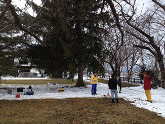
|
| December 2, 2013 | Exploration of haniwa trains using ground penetrating radar and metal detectors at Gyoda City, Saitama Prefecture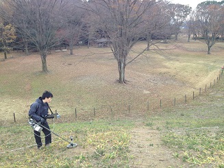
|
| November 12, 2013 | Ground penetrating radar measurement at the Kamishibusa Harada site in Minamisoma City, Fukushima Prefecture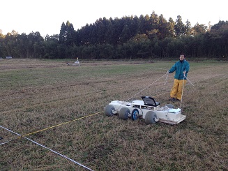
|
| Nov.5-6, 2013 | Ground penetrating radar measurement at Biwazuka Kofun, Oyama City, Tochigi Prefecture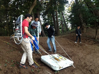
|
| September 12, 2013 | Ground penetrating radar measurement and confirmation of excavation results at Dangoyama Kofun, Sukagawa City, Fukushima Prefecture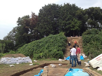
|
| September 11, 2013 | Ground penetrating radar measurement at the site of Nobiruchikukou, Higashimatsushima City, Miyagi Prefecture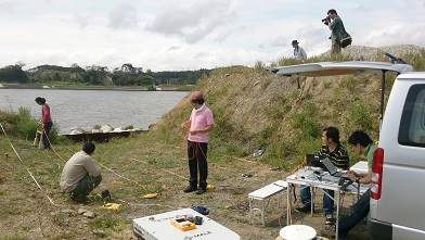
|
12th Underground Electromagnetic Measurement Workshop (held on November 23rd and 24th, 2013)
| Presentation by Liu Hai (Industry-Academia-Government Collaboration Research Fellow) | 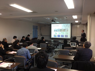 |
| Presentation by Yi LI (2nd year master's program, Graduate School of Environmental Studies) | 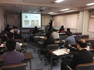 |
| Introduction of array type ground penetrating radar | 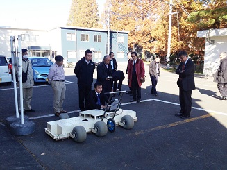 |
| Exhibition of 3D GPR equipment capable of high-precision survey | 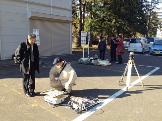 |
contact information
〒980-857641 Kawauchi, Aoba-ku, Sendai City, Miyagi
Center for Northeast Asian Studies, Tohoku University
Resources and Informatics Laboratory Sato Genyuki Laboratory
Tel&Fax: 022-795-6074
E-mail: motoyuki.sato.b3(at)tohoku.ac.jp